 View from the butte
 Little town of Sentinel Butte, ND
  Leland throwing rocks (just can't help himself)
 The butte itself is about 300 feet tall with a wide, flat space on top with a commanding view of the surrounding area. Even though the temperature right now is about 60, there is still snow - fresh snow! - on top of the butte. However, excavating today in the sun was quite pleasant.
 Cold!
Cold! People often ask me what we're doing out here and what we are trying to find, so I thought I'd use our field days on Thursday and Friday and our excavation today to explain what a modern non-academic archaeologist does.The field itself is called Cultural Resource Management, or CRM. It exists because of a law stating that any construction project which involves federal money must perform an archaeological survey to look for cultural resources (archaeological sites) which will be destroyed by the construction. These companies - building roads, wells, pipelines - contract this task out to CRM firms like the one we work for.
The first step is called Phase I, or survey, and it means just walking around the land and looking for stuff. Everywhere in the project area, a survey crew must cover on foot (as long as it is on flat land - no point looking for anything on steep hills). We line up in a straight line, 20 meters apart, and walk forward in a straight line looking at the ground for a predetermined length (anywhere from 100 feet to a mile or longer). The line we walk is called the transect. Because we use a scientific method of sampling the area, the assumption is that we won't miss any important sites. This also means that we must walk in a straight line regardless of obstructions - no picking the easiest path over the landscape. We do detour around, you know, lakes and stuff, but then we line up again on the other side of any un-walkable obstruction.
So what do we look for? Generally, we look for artifacts we know we might find. Everywhere in the US we look for lithics, or stone that has been culturally modified, made into knives and arrowheads and spears by Native Americans. Conveniently, rock that is able to be used this way is kind of shiny and distinctive.
 Stone knife from Illinois
 Example of a tool I found last year
 The above picture is of an actual stone tool, possibly a drill. However, we usually find just flakes of rock that came off while the tool was being made.We also might look here on the plains for stone circles or tipi circles, which are circles of rocks that were once used to hold down the edges of tipis. Last week we found about fifteen circles in one large site.
Sometimes, we find even more subtle changes in the landscape that represent an area where there was a settlement or something like earthen ramparts (walls of dirt built to surround and protect a village site.
 Earthen ramparts from an already discovered site in the area we were surveying Thursday and Friday. (I know they're a little hard to see in the picture - the low areas are the ramparts.) If they are this obvious, they have already been found a looooong time ago.
If we find enough cool stuff located in a single place, we might move to a Phase II, where we go back to one or two sites in the project area and actually dig to see what is below the surface. If we find enough there, we return again for the most intensive dig, Phase III mitigation. We put in several square pits, or units, which we dig in discrete levels. After a predetermined depth (such as 10 centimeters below the ground level, or when we reach a specific change in the dirt type) we stop, collect all the artifacts from that level, complete paperwork for that level, and start again with a new level.
We do this until we hit a sterile level, meaning one with no artifacts in it.We also screen the dirt so we can make sure we get all the artifacts out of it, and take samples that we don't screen but bring back to the lab so we can wash everything in the sample and look at the contents even more closely.

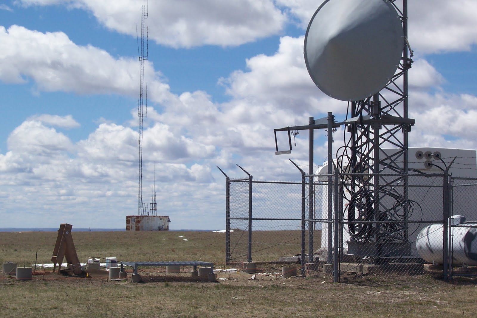 Our excavation with two open units
 You can see here we're right next to a radio tower. They want to expand this construction in some way and because other sites have been found on this butte, we need to go in and make sure that the construction won't destroy any important stuff (note: we have not found any important stuff so far).
And that's what we do in the field!
 Don't you wish this was the view from your office?
No comments:
Post a Comment